
This was an event organised by Sustrans (the cycle eco warriors). It offered a 56 mile route (90km) and a 26 mile route (42km). It used a mixture of Sustrans off road trails, roads and some cross country on bridleways.
The event started at the Create Centre in Bristol with over 150 riders registering between 9am and 11am. I set off on an empty track at about 10am. The section near Avonmouth was fairly industrial and was then followed by a hill climb that was a bit close to the motorway. Things improved with a downhill run from the Cadbury hill. There was then a long flattish backroad section to the first cake stop at Yatton station.
The route then used the Strawberry line (Sustrans route 26) to Cheddar (Wikipedia information. This a gravelled section of disused railway and was ever so slightly up hill. I had a good race with another rider along here and we caught a few people on the climb to the Shute Shelve Tunnel under the Mendips.
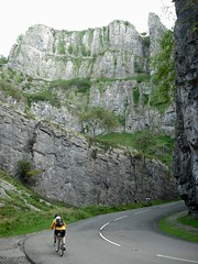
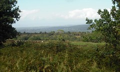
After Cheddar it was a 3 mile climb up Cheddar Gorge and then the route kept on climbing until it reached the radio masts near Charterhouse. There was a great view from here down to the Bristol channel.
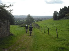
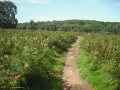
We now had the first decent off road section on a Bridleway round the Mendips. I missed a sign somewhere and ended up in Shipham rather than Burrington. I wasn’t too bothered – I’d had a fun ride along a rock strewn path and it was an easy fix to cycle along the A38 through Lower Langford and I soon rejoined the route.
There was a major food stop at Wrington.
I wasn’t looking forwards to the climb back up towards Bristol, but it went past pretty quickly. A long, muddy vehicle track lead through the woods with the airport buildings visible in the distance. I caught some riders up here and was interested to see the no3 rider. I was no54 so I was gaining ground.
There was a good single track decent to Flax Bourton and another food stop. The marshals here told me that I was the sixth rider that they’d seen, which was nice to know.
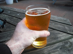
The final climb led up to Failand. A sign was missing in this section so I ended up coming out of the woods to find I’d caught back up with no3. After a bit of fast road the route used some more singletrack in Ashton Court woods. It then cunningly nipped through a few paths to end up by the start, though this wasn’t the finish yet. A short urban section lead to the finish at the Tobacco Factory in Southville. There was a good welcome here and I finished the day with a pint of cider from the bar.
The Bikely map that I drew says 95km (59miles) and 1150m of ascent.
It was a well organised event with plenty of food and cakes at the stops. It was good to cover some ground on roads and easy paths. I look forwards to the 2011 Sustrans Cheddar Adventure.
 |
 |
 |
 |
 |
 |
 |
 |
 |
 |
Original Sustrans Route map
